In 2017, Lake Ontario’s water level rose to the highest it had ever been in the 100 years of record keeping, topping out at 75.81m above sea level. It was a once in a hundred-year flood. This year, 2019, Lake Ontario again rose well above normal. In fact, it topped out at 75.92m, a full 11cm above the old record! There have been some similarities with 2017, but also some differences.
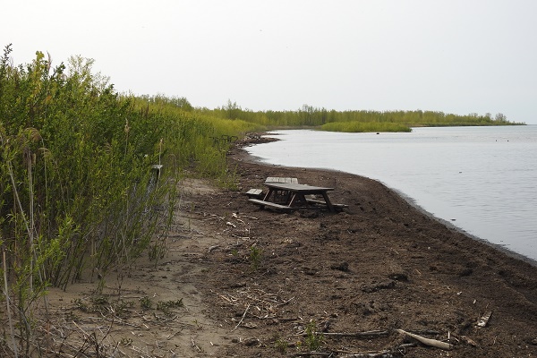
By May 1st, 2019, the lake was at 75.41cm (40cm above the long-term average) and the Marsh Boardwalk was closed between the towers. By May 8th the lake was high but not as high as in 2017 and we were hopeful. But the lake started to rise faster, going up 10cms in 3 days. By May 10th at 75.62m, the Calf Pasture parking lot was closed as was the Beach 1 parking lot. The latter was quite flooded but more due to rain than lake levels. By contrast, Beach 2 parking was quite dry, and it was kept open, unlike in 2017 when we had all beach parking lots closed until the end of July. But the beach was shrinking. By May 18th, with the lake at 75.76m, most of the beach was gone. and still the water rose.
On May 22nd the lake broke the 2017 record going over 75.81 metres. Despite the high water, we did not close the park as we did in 2017. This was mostly due to the lower amount of rain. Despite having four times the May rain in 2019 (131mm) that we did in 2018 (31mm), we still had much less than in 2017 (247mm). This allowed some campsite to dry out between rains. Still Zach, our assistant clerk, spent much of late May and June calling people to give them options on their forth-coming reservations because their sites were unusable.
Beach 1 parking lot remained flooded into June and this unfortunately caused the cancelling of the grand opening of the beach mat access route the Friends were organizing. The mat had been put in place in April but now there was no dry place to do a ribbon cutting ceremony! This project had been paid for by Park, Friends and community organizations, so we missed a chance to celebrate this collaboration.
Despite the high-water levels, it was the high winds and waves that caused our greatest concerns. High winds on June 3rd resulted in water going over the loop road at Chatterson Point and it was closed for a day. Those waves also flooded the Lighthouse parking lot and eroded the shoreline in Day Use and the Campgrounds. One loop in Elmvale was closed as the road was starting to erode.

Beach
High winds hit again on June 11th and June 14th. The latter was particularly high—the High Bluff causeway was impassable, and part of the High Bluff campground was evacuated. In addition, thousands of pounds of cobbles were thrown up on the day use area and covered the walkway heading to the lighthouse. The end of that Elmvale loop road and the bike path that used it, completely disappeared. The 8 campsites along this route remained closed for the rest of the year. It is being considered to turn these sites into walk-in sites in 2020.
Still we had the park ready for the summer rush by Canada Day with the park running much as normal with some facilities closed. About 10 campsites were closed, the Marsh Boardwalk remained closed between the towers and the Calf Pasture parking area was underwater and closed. The beach parking lots were all opened, though the beach was mostly under water.
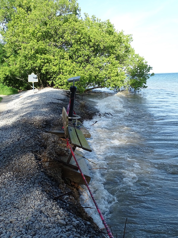
From the peak water level in June the water slowly started receding in July. It went down 18cms that month, but it was still high and our shoreline was suspectable to wind and wave erosion. Strong south winds in mid-July kept eating away our shoreline and by July 21st a bench and the Hi-Spy telescope at the Lighthouse Centre started slipping into the lake and had to be rescued and moved.

bench and the Hi-Spy telescope at the Lighthouse Centre started slipping into the lake
Water really started dropping in August, going down 33cm. By the end of the month we had the Calf Pasture area open and the beach had reappeared. Unfortunately, the Marsh Boardwalk between the towers had floated free and was off its footings and will remained closed for the foreseeable future until it can be repaired. The water dropped a further 24 cms in September and by the end of the month the lake was at what would be a normal high spring level!
So, two 100 - year floods in 3 years. Is this the new norm? Certainly, we have learned a lot about what part of our park is vulnerable to high water events and will plan accordingly in future infrastructure projects.


